Remote Infrastructure Monitoring: IoT & Cloud for 24/7
In August 2018, the Majerhat bridge in Kolkata collapsed without warning, killing three people and disrupting a major arterial corridor for months. Post-incident investigations pointed to long-term deterioration that periodic visual inspections had failed to detect. That single event crystallised a question every asset owner and facility manager in India must now answer: how do you know what is happening inside your structure at 2 a.m. on a monsoon night? The answer, increasingly, is remote infrastructure monitoring — continuous, sensor-driven surveillance that transmits structural data to a cloud platform in real time, independent of any human presence on site.
Remote infrastructure monitoring has moved from research laboratories to live national highway tunnels, urban high-rises, and railway bridges across India. With NHAI mandating instrumentation on major tunnels and the Dam Safety Act 2021 requiring continuous monitoring for large reservoirs, the regulatory environment is now aligned with the technology. This post explains the IoT architecture that makes it work, the connectivity options suited to Indian field conditions, and the measurable operational value it delivers to asset owners and facility managers.
Key Takeaways
- Remote infrastructure monitoring is the continuous, automated acquisition and transmission of structural parameters — strain, displacement, vibration, pore pressure — from embedded sensors to a cloud platform, enabling real-time condition assessment without on-site personnel.
- A well-designed IoT architecture layers field sensors, edge data loggers, wireless or cellular gateways, and a cloud SHM dashboard — each layer performing a distinct function that the others cannot substitute.
- Indian regulatory mandates under the Dam Safety Act 2021, NHAI tunnel guidelines, and IRC SP-35 for bridges are accelerating adoption of remote SHM across public infrastructure.
- Connectivity choice — 4G LTE, LoRaWAN, or satellite — must be matched to site geography, data rate requirements, and power availability; no single protocol suits every Indian field condition.
- Projects such as the MIT-WPU Tunnel Health Monitoring and Digital Twin Excellence Centre and the RITES 3D Digital Twin platform for bridge health monitoring demonstrate that remote monitoring can integrate with digital twin environments for predictive maintenance.
What Remote Infrastructure Monitoring Actually Means
Remote infrastructure monitoring is the automated, continuous measurement of structural and geotechnical parameters at a physical asset — such as a bridge, tunnel, dam, or building — and the transmission of that data over a communication network to a centralised platform where engineers can assess structural condition without being physically present at the site.
The term is sometimes used loosely to mean any form of instrumentation, but precision matters here. A vibrating wire piezometer installed in a dam embankment and read manually once a week is instrumentation. The same piezometer connected to a datalogger that pushes readings every 15 minutes to a cloud dashboard — triggering an SMS alert if pore pressure exceeds a threshold defined in CWC guidelines — is remote infrastructure monitoring. The distinction is not semantic; it determines whether an engineer can intervene before a threshold is breached or only after a failure has occurred.
Parameters commonly monitored include: crack width (mm), structural displacement (mm), rebar strain (micro-strain, µε), vibration acceleration (mm/s²), tilt (milliradians), pore water pressure (kPa), load in anchor tendons (kN), and ambient temperature (°C). The combination of parameters selected depends on the structural typology and the failure modes being guarded against, as defined in the monitoring plan prepared under IS 1892 for geotechnical works or IRC SP-35 for bridges.
For a deeper grounding in the discipline, the post on what is structural health monitoring and why does it matter covers the foundational concepts that underpin any remote monitoring deployment.
IoT Architecture for Remote Infrastructure Monitoring
A production-grade IoT architecture for remote SHM comprises four distinct layers. Understanding each layer prevents the most common procurement mistake: buying sensors without a coherent plan for how data moves from the sensor face to an engineer's screen.
Layer 1 — Sensing: Transducers convert physical phenomena into electrical signals. Vibrating wire sensors output frequency (Hz) proportional to strain or pressure. MEMS accelerometers output voltage proportional to acceleration in mm/s². Fibre Bragg grating (FBG) sensors output wavelength shift (pm) proportional to strain or temperature. The choice of sensing technology determines the signal conditioning required at Layer 2 and the achievable measurement resolution — typically ±0.025% full scale for vibrating wire and sub-microstrain for FBG systems.
Layer 2 — Edge Data Acquisition: A field datalogger — such as the Geolook Gateway — conditions raw sensor signals, applies calibration coefficients, timestamps readings with GPS-synchronised clocks, and stores data locally in non-volatile memory. Edge processing at this layer is critical: it allows the device to continue logging during communication outages and to apply threshold logic locally, reducing unnecessary data transmission and conserving cellular data budgets.
Layer 3 — Connectivity: The conditioned, timestamped data packet is transmitted over a communication channel. Options include 4G LTE (latency under 100 ms, suitable for urban and highway corridors), LoRaWAN (range up to 15 km line-of-sight, low power, suitable for remote dams and slopes), NB-IoT (deep penetration into underground structures such as tunnels), and VSAT satellite (last-resort connectivity for Himalayan or island sites). Protocol selection must account for the data rate required — a 32-channel vibrating wire logger sampling at 10-minute intervals generates far less data than a 24-axis accelerometer array sampling at 200 Hz for dynamic modal analysis.
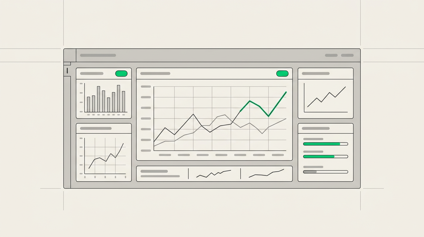
Layer 4 — Cloud Platform and Visualisation: Received data is ingested into a cloud SHM platform, stored in a time-series database, and presented through a web dashboard. A well-engineered platform provides configurable alert thresholds, automated report generation, role-based access for different stakeholders, and API endpoints for integration with BIM or digital twin environments. The Geolook SHM software platform is designed around this architecture, supporting multi-site aggregation so a facility manager can view the condition of ten bridges or five tunnels from a single interface.
Connectivity Options Compared: Matching Protocol to Indian Field Conditions
India's infrastructure portfolio spans dense urban corridors, remote Himalayan tunnels, coastal bridges, and riverine dam sites. No single connectivity protocol is optimal across all these environments. The table below compares the protocols most commonly deployed in IoT infrastructure monitoring projects in India.
| Protocol | Typical Range | Data Rate | Power Requirement | Best-Fit Application | Indian Field Limitation |
|---|---|---|---|---|---|
| 4G LTE / 5G | Network-dependent | Up to 150 Mbps | High (requires mains or large battery) | Urban bridges, highway tunnels, high-rise buildings | No coverage in remote Himalayan or forest corridors |
| LoRaWAN | Up to 15 km (LoS) | 0.3–50 kbps | Very low (battery-operated for years) | Dam embankments, remote slopes, rural bridges | Gateway infrastructure must be self-deployed; limited public network |
| NB-IoT | Network-dependent | ~250 kbps | Low | Underground tunnels, basement excavations | Requires telecom operator NB-IoT rollout; patchy outside metros |
| Wi-Fi (802.11) | Up to 100 m | Up to 600 Mbps | Medium | Indoor structures, control rooms, laboratory setups | Not suitable for outdoor field deployments without repeaters |
| VSAT Satellite | Global | Up to 50 Mbps | High (dish + power) | Himalayan tunnels, island infrastructure, BRO projects | High equipment and subscription cost; latency 600–700 ms |
| RS-485 Wired | Up to 1.2 km | Up to 10 Mbps | Low | Dam galleries, tunnel instrumentation arrays | Cable installation cost; vulnerability to rodent damage and flooding |
For most NHAI highway tunnel projects — such as the five-tunnel real-time SHM deployment on NH-44 in the Ramban-Banihal section — a hybrid approach combining RS-485 wired sensor buses within the tunnel with 4G LTE backhaul at the portal provides the reliability required for continuous convergence and structural load monitoring in NATM-excavated sections.
Regulatory Drivers for Remote SHM in India
Asset owners and facility managers operating under Indian regulatory frameworks are no longer evaluating remote infrastructure monitoring as an optional upgrade. Several instruments now create direct obligations or strong incentives.
The Dam Safety Act 2021 (No. 35 of 2021) mandates that every specified dam maintain an instrumentation and monitoring system and submit periodic safety reports to the National Dam Safety Authority. For large dams — defined as those exceeding 15 metres in height — continuous monitoring of piezometric levels, seepage, and deformation is the only practical means of meeting the reporting frequency required. CWC guidelines on dam instrumentation specify the sensor types and measurement intervals appropriate for each dam typology.
For bridges, IRC SP-35 (Guidelines for Inspection and Maintenance of Bridges) and the emerging IRC SP-37 framework for structural health monitoring of bridges define the instrumentation parameters and inspection intervals that asset owners must maintain. NHAI's internal guidelines for major bridges on national highways increasingly reference continuous monitoring as the standard of care for structures with spans exceeding 100 metres or those in seismically active zones classified under IS 1893.
For tunnels, MORTH's guidelines on tunnel safety and NHAI's project-specific monitoring requirements — as applied on NH-44 — specify convergence monitoring intervals, load cell readings on support systems, and the retention of monitoring records for the design life of the structure.
Understanding the full scope of structural health monitoring requirements across these asset classes helps facility managers build a compliance-aligned monitoring programme rather than a reactive one.
Digital Twin Integration: From Data Stream to Predictive Intelligence
The highest-value application of remote infrastructure monitoring is not alert generation — it is the continuous calibration of a structural model against live sensor data. This is the premise of a digital twin: a computational representation of a physical asset that is updated in real time by sensor inputs and used to predict future structural states.
Geolook's work with RITES Ltd on the 3D Digital Twin and VR Visualisation Platform for Bridge Health Monitoring System demonstrates this integration in a government PSU context. Sensor data from bridge instrumentation arrays is ingested into a 3D model, allowing engineers to visualise strain distribution, deflection profiles, and bearing load histories spatially — not just as time-series graphs. This shifts the monitoring function from reactive (alert when a threshold is crossed) to predictive (model when a threshold will be approached under projected traffic loading).
The MIT-WPU Tunnel Health Monitoring and Digital Twin Excellence Centre, inaugurated by Hon'ble Minister Sh. Nitin Gadkari, extends this concept into a research and training environment where IoT sensor streams from instrumented tunnel sections feed a live digital twin used for both operational monitoring and engineer training. The centre represents a convergence of remote SHM, AI-enabled analytics, and immersive visualisation that defines the direction of the discipline in India.
For asset owners considering this trajectory, the post on machine learning in structural health monitoring explains how ML algorithms applied to continuous sensor streams can detect anomalous structural behaviour before it manifests as a visible defect or a threshold breach.
The architecture that enables digital twin integration requires the cloud platform to expose structured APIs. Raw sensor data must be timestamped, georeferenced, and tagged with sensor metadata — channel ID, calibration coefficients, engineering unit — before it enters the twin model. This is a data governance requirement, not merely a software feature, and it must be specified at the procurement stage.
Operational Value for Asset Owners and Facility Managers
The business case for remote infrastructure monitoring rests on three operational realities that asset owners and facility managers encounter repeatedly.
Reduced inspection travel and mobilisation cost: A structural engineer visiting a remote bridge or tunnel site in a Himalayan corridor may spend two days in transit for a four-hour inspection. Remote monitoring does not eliminate the need for periodic physical inspections, but it changes their frequency and purpose. Instead of routine condition checks, site visits become targeted investigations triggered by specific sensor anomalies. The Geolook datalogger range is designed for unattended field operation across extended periods, with local data storage that ensures no readings are lost during communication outages.
Earlier detection of deterioration: Structural deterioration is rarely sudden. Crack propagation, settlement accumulation, and bearing degradation develop over weeks or months. A continuous monitoring system sampling at 15-minute intervals generates 2,880 data points per channel per month — a resolution that reveals trends invisible to quarterly inspections. For the DLF Downtown Gurgaon project instrumented by Geolook through Ahluwalia Constructions, industrial-grade DAQ and real-time settlement monitoring during deep excavation provided the construction team with continuous deformation data that informed daily excavation decisions.
Compliance documentation: Regulatory submissions to NDMA, CWC, NHAI, or RITES require structured monitoring records with timestamps, calibration traceability, and threshold exceedance logs. A cloud-based remote monitoring platform generates these records automatically, reducing the administrative burden on facility management teams and providing an auditable data trail for the asset's operational life.
For transport infrastructure specifically, the Geolook transport infrastructure monitoring solutions page outlines how these principles are applied across highway, rail, and tunnel asset classes.
Deployment Considerations: What Asset Owners Must Specify
A remote infrastructure monitoring system that performs well in a factory acceptance test can fail in the field if deployment conditions are not specified correctly at the procurement stage. Asset owners and facility managers should require the following to be addressed explicitly in any tender or supply contract.
Power architecture: Specify whether mains power is available at the sensor location. If not, the system must be solar-powered with a battery backup sized for the longest expected period of cloud cover at the site latitude. For sites in Jammu and Kashmir or the Northeast, winter insolation data from the Indian Meteorological Department should be used to size the battery bank.
Data continuity during communication outages: The datalogger must have sufficient onboard non-volatile storage to buffer data for a minimum period — typically 30 days — without overwriting. This is non-negotiable for remote sites where cellular connectivity is intermittent.
Sensor-to-platform calibration traceability: Every sensor must have a calibration certificate traceable to NABL-accredited standards. The calibration coefficients must be entered into the cloud platform so that raw electrical outputs are converted to engineering units — kPa, µε, mm — at the logger level, not post-hoc in a spreadsheet.
Cybersecurity: Cloud platforms receiving structural data from critical national infrastructure must implement encrypted data transmission (TLS 1.2 or higher), role-based access control, and audit logging. This is increasingly a requirement in NHAI and RITES procurement specifications.
Understanding how a web data monitoring system handles data ingestion, storage, and access control helps facility managers evaluate platform proposals against these requirements objectively.
Frequently Asked Questions
Q: What is remote infrastructure monitoring and how does it differ from periodic inspection?
A: Remote infrastructure monitoring is the automated, continuous measurement and transmission of structural parameters — such as strain in µε, displacement in mm, or pore pressure in kPa — from embedded sensors to a cloud platform, without requiring an engineer to be physically present. Periodic inspection captures a snapshot at a single point in time; remote monitoring provides a continuous record that reveals trends and rate-of-change data that inspections cannot detect.
Q: Which Indian standards govern the instrumentation requirements for remote SHM on bridges and tunnels?
A: IRC SP-35 governs inspection and maintenance of bridges and references instrumentation requirements for major structures. IS 1893 defines seismic zone classifications that influence sensor selection for dynamic monitoring. For tunnels on national highways, MORTH and NHAI project-specific guidelines specify convergence monitoring intervals and load cell reading frequencies. The Dam Safety Act 2021 and CWC guidelines govern instrumentation for large dams above 15 metres in height.
Q: What connectivity protocol is most reliable for remote SHM in areas with poor cellular coverage?
A: LoRaWAN is the most reliable low-power option for remote sites with poor cellular coverage, offering ranges up to 15 km line-of-sight with battery-operated nodes that can function for years without maintenance. For Himalayan or island sites where even LoRaWAN gateway deployment is impractical, VSAT satellite backhaul provides universal coverage, though at higher equipment and operational cost.
Q: How does IoT infrastructure monitoring integrate with a digital twin platform?
A: IoT infrastructure monitoring feeds a digital twin by streaming timestamped, georeferenced sensor data — strain, displacement, temperature, vibration — through structured APIs into a 3D computational model of the structure. The model is continuously updated against live readings, allowing engineers to visualise spatial stress distributions and predict future structural states under projected loading, rather than simply reacting to threshold breaches after they occur.
Q: What is the minimum data storage requirement for a remote monitoring datalogger deployed at a site with intermittent connectivity?
A: A remote monitoring datalogger deployed at a site with intermittent connectivity should provide a minimum of 30 days of onboard non-volatile data storage at the configured sampling interval, without overwriting earlier records. This ensures that no structural data is lost during communication outages, and that the full dataset is available for upload and analysis once connectivity is restored.
Explore remote monitoring
Geolook designs and deploys end-to-end remote infrastructure monitoring systems — from field sensors and edge dataloggers to cloud SHM dashboards and digital twin integration — for asset owners, EPCs, and government agencies across India. Whether your asset is a highway tunnel in a seismically active zone, a high-rise under construction in an urban corridor, or a bridge on a national highway requiring IRC SP-35 compliance, the architecture described in this post can be configured to your specific structural typology, connectivity environment, and regulatory obligations.
To discuss a monitoring requirement or request a technical proposal, contact the Geolook engineering team. For a detailed overview of the sensor and datalogger hardware that forms the field layer of any remote monitoring deployment, visit the Geolook datalogger and sensor product range.
Project inquiry
Talk to a Geolook™ specialist
Share your monitoring requirement and our team will help identify the right next step.
By submitting, you agree that Geolook™ may contact you about this inquiry. Your details are not added to a marketing list.