Slope Stability Monitoring: Instruments, Methods & Alerts
In August 2010, cloudbursts triggered catastrophic landslides across Leh, Ladakh, killing over 200 people and destroying infrastructure built over decades — a stark reminder that slope failure in India is not a low-probability event. According to the National Disaster Management Authority (NDMA), India accounts for roughly 30 of the world's 50 most landslide-prone districts, with the Himalayas, Western Ghats, and Northeast hill ranges facing perennial risk. For geotechnical engineers and EPC project managers working on highways, railways, and hydropower corridors through these zones, slope stability monitoring is not optional instrumentation — it is the primary line of defence between early warning and catastrophic loss.
This guide covers the instruments, methods, and real-time alert architectures that constitute a technically defensible slope monitoring system under Indian conditions, with reference to IS 14458 and NDMA guidelines on landslides.
Key Takeaways
- Slope stability monitoring integrates subsurface deformation, pore water pressure, and surface displacement data to detect precursory movement before visible failure occurs.
- IS 14458 (Retaining Walls for Hill Area) and NDMA landslide guidelines define the minimum instrumentation and alert thresholds applicable to Indian highway and railway slopes.
- A slope inclinometer remains the primary instrument for measuring sub-surface lateral displacement; MEMS-based digital variants now enable automated, continuous readings without manual traversal.
- Real-time alert systems require defined threshold tiers — typically yellow, orange, and red — linked to automated notifications and pre-agreed response protocols.
- Instrument selection must account for geology, slope height, failure mode (translational vs. rotational vs. debris flow), and data telemetry constraints in remote terrain.
What Is Slope Stability Monitoring?
Slope stability monitoring is the systematic measurement of geotechnical parameters — lateral displacement, pore water pressure, surface movement, rainfall intensity, and ground vibration — to detect precursory signs of slope failure and trigger timely intervention. It is applied to natural hillsides, engineered cut slopes, embankments, and retaining structures across road, rail, dam, and urban infrastructure projects. A well-designed slope monitoring system converts raw sensor data into actionable engineering intelligence, enabling project teams to distinguish between seasonal creep and accelerating failure kinematics.
The discipline sits at the intersection of geotechnical instrumentation, data acquisition, and risk management. In the Indian regulatory context, NDMA's Guidelines on Landslide Hazard Management (2009) and IS 14458:1998 provide the foundational framework for instrument selection, threshold setting, and emergency response planning on hill-area infrastructure projects.
For a broader view of how these systems are deployed across Indian highway and railway corridors, see our detailed resource on landslide monitoring india.
Failure Modes That Instrumentation Must Detect
Instrument selection is governed by the anticipated failure mechanism. The three primary failure modes on Indian geotechnical slopes are:
- Translational sliding: Movement along a planar discontinuity, common in Himalayan schist and phyllite. Requires inclinometer arrays and piezometers at the slip surface depth.
- Rotational failure: Circular slip in cohesive soils and weathered rock. Requires inclinometers at multiple depths plus surface survey monuments.
- Debris flow and shallow landslides: Triggered by intense rainfall infiltration. Requires rain gauges, shallow piezometers, and surface extensometers or GNSS sensors.
IS 1892:1979 (Code of Practice for Site Investigations for Foundations) provides guidance on sub-surface investigation methods that inform instrument placement depth and spacing. The Geological Survey of India (GSI) Landslide Hazard Zonation maps, available at district level, are the standard reference for identifying susceptible formations before instrumentation design begins.
Understanding which failure mode dominates also determines the critical monitoring frequency. A translational slide on a saturated clay-shale interface may require readings every 15 minutes during monsoon, whereas a dry-season creep on a stable embankment may tolerate daily automated readings.
Core Instruments in a Slope Monitoring System
A complete slope monitoring system typically integrates five instrument categories, each measuring a distinct physical parameter:
- Slope Inclinometer (SI): Measures lateral displacement of a borehole casing at discrete depth intervals, typically 0.5 m. Conventional manual traversal with a torpedo probe gives displacement profiles in two orthogonal planes. Cumulative displacement at the slip surface — often expressed in mm — is the primary stability indicator. The slope inclinometer is mandated in most NHAI and RVNL slope instrumentation specifications for cut slopes exceeding 10 m height.
- MEMS Digital In-Place Inclinometer (IPI): A string of MEMS accelerometer-based sensors installed permanently in the inclinometer casing. Each sensor node measures inclination at a fixed depth, enabling automated, continuous data acquisition without manual traversal. Resolution is typically ±0.01° with a measurement range of ±30°. Geolook's MEMS digital inclinometer is designed for continuous telemetry in remote terrain, eliminating the access constraints of manual probes during monsoon-season events.
- Vibrating Wire Piezometer (VWP): Measures pore water pressure (kPa) at the slip surface or within the saturated zone. Pore pressure build-up is the primary trigger for most rainfall-induced landslides. VWPs are installed in sealed boreholes and read via datalogger at intervals as short as 1 minute during storm events. IS 2720 (Part 36) provides the laboratory reference for pore pressure measurement in soil specimens, which informs field calibration.
- Rain Gauge (Tipping Bucket): Measures cumulative and intensity rainfall (mm/hr). NDMA guidelines recommend correlating antecedent rainfall over 3-day and 7-day windows with displacement rate to establish site-specific rainfall thresholds for alert issuance.
- GNSS / Total Station Prism Monuments: Surface displacement monitoring in three dimensions (X, Y, Z) to mm-level accuracy. Suitable for monitoring the full slope extent where subsurface instrumentation covers only discrete boreholes. Automated motorised total stations can scan arrays of 20–50 prisms at 15-minute intervals.
- Crack Meters and Wire Extensometers: Measure opening of tension cracks at the crown of a potential slide mass, typically in mm. Crack opening rate is a reliable precursory indicator of imminent failure in rotational slides.
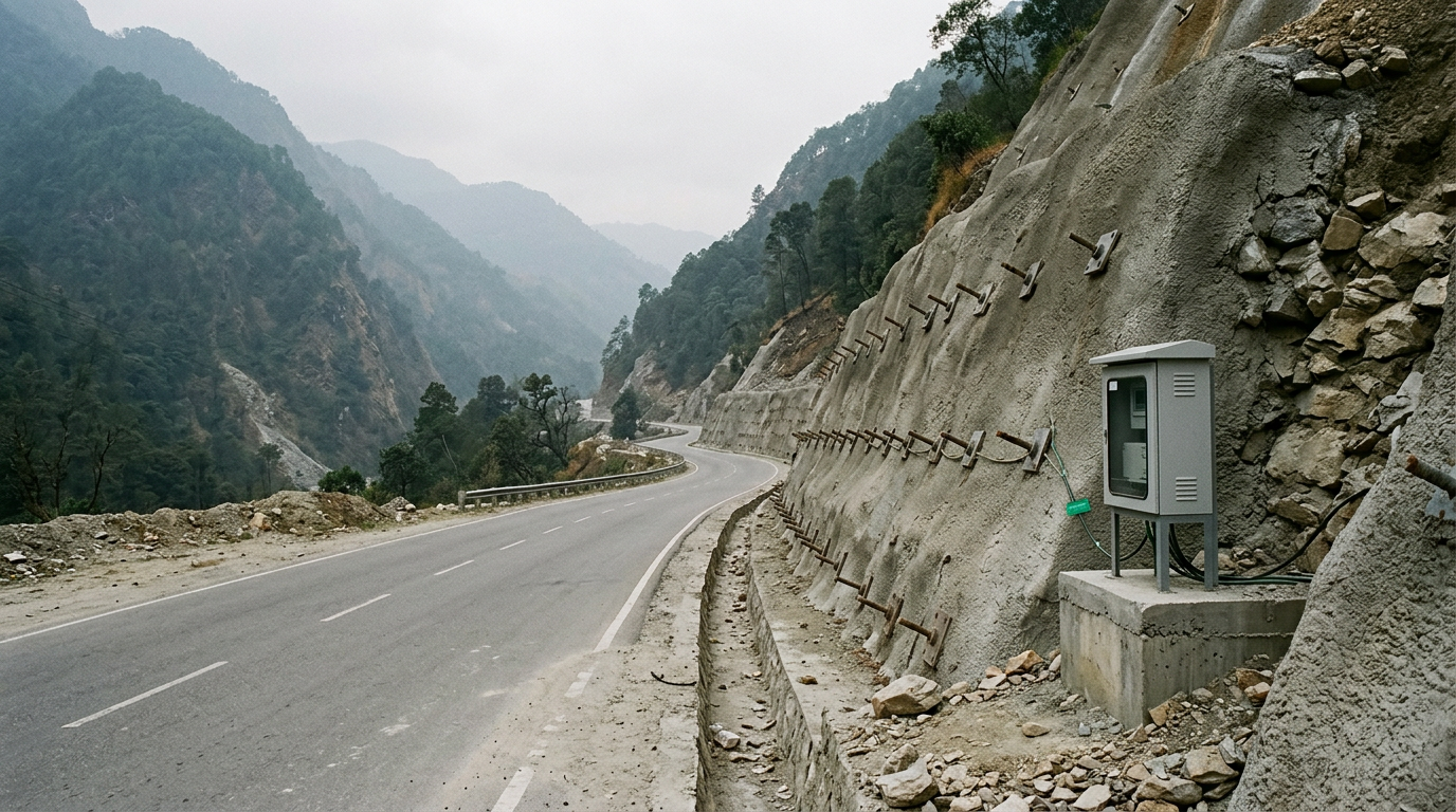
For projects on national highway corridors, Geolook's landslide monitoring instrumentation suite covers the full sensor stack from borehole instruments to surface GNSS, with integrated datalogger and cloud telemetry.
Comparison of Slope Monitoring Methods
The table below compares the principal slope monitoring methods across parameters relevant to geotechnical engineers and EPC procurement teams. Method selection depends on slope geometry, failure mode, access constraints, budget, and required response time.
| Method | Parameter Measured | Measurement Range | Typical Resolution | Data Frequency | Best Suited For |
|---|---|---|---|---|---|
| Manual Slope Inclinometer Traversal | Sub-surface lateral displacement (mm) | ±30° inclination | 0.02 mm per 0.5 m gauge length | Weekly to monthly | Baseline profiling, periodic compliance checks |
| MEMS In-Place Inclinometer (IPI) | Sub-surface lateral displacement (mm), continuous | ±30° | ±0.01° | 1 min to 15 min automated | Real-time alert systems, remote/inaccessible slopes |
| Vibrating Wire Piezometer | Pore water pressure (kPa) | 0–700 kPa (site-specific) | 0.025% FS | 1 min to 1 hr automated | Rainfall-triggered failure, saturated slopes |
| GNSS Surface Monument | 3D surface displacement (mm) | Unlimited range | ±2–5 mm horizontal, ±5–10 mm vertical | 15 min to daily | Whole-slope surface kinematics, large slide masses |
| Automated Total Station (ATS) | 3D surface displacement (mm) | Up to 1,000 m range | ±1 mm | 15 min to 1 hr | Highway slopes, dam abutments, urban cut slopes |
| Tipping Bucket Rain Gauge | Rainfall intensity (mm/hr), cumulative (mm) | 0–500 mm/hr | 0.2 mm per tip | 1 min continuous | Rainfall threshold correlation, debris flow warning |
| Wire Extensometer / Crack Meter | Crack opening displacement (mm) | 0–100 mm (standard) | 0.01 mm | 1 min to 1 hr automated | Crown crack monitoring, imminent failure detection |
Real-Time Alert Architecture for Geotechnical Slopes
A real-time slope monitoring system is only as effective as its alert logic. Raw sensor data without defined thresholds and response protocols provides no operational value during a crisis. The standard architecture for Indian highway and railway slope projects follows a three-tier threshold model, consistent with NDMA landslide warning framework principles:
- Yellow (Watch): Displacement rate exceeds background creep but remains below the design alert level. Trigger: increased monitoring frequency, site inspection within 24 hours, notification to project engineer.
- Orange (Warning): Displacement rate or pore pressure crosses the pre-defined warning threshold. Trigger: immediate site inspection, traffic management measures, notification to NHAI/RVNL regional office, geotechnical review.
- Red (Alarm): Displacement rate indicates accelerating failure kinematics (typically identified by inverse velocity method). Trigger: immediate evacuation, road/rail closure, emergency response activation.
Threshold values are site-specific and must be established during the instrumentation design phase based on slope geometry, factor of safety analysis (per IS 14458), and back-analysis of historical movement data where available. A common starting reference for cut slopes in Himalayan terrain is a displacement rate of 5 mm/day as a yellow threshold and 20 mm/day as a red threshold, but these must be validated against site-specific stability analysis — not applied generically.
Data telemetry in remote hill terrain typically uses GSM/4G modems with solar power and battery backup. Where cellular coverage is absent, satellite modems (VSAT or Iridium) are specified. Dataloggers must be rated for the ambient temperature range of the deployment zone — in Ladakh and Spiti, this can reach −30°C in winter.
For a detailed treatment of how real-time systems are configured for landslide prevention on Indian infrastructure corridors, refer to our guide on real time slope monitoring system for landslide prevention india.
Instrument Placement and Borehole Design
Instrument performance is determined as much by installation quality as by sensor specification. For slope inclinometers and piezometers, borehole design is critical. Key requirements under Indian practice:
- Borehole depth: Must extend at least 3–5 m below the anticipated slip surface, confirmed by sub-surface investigation per IS 1892. Insufficient depth results in a fixed-base assumption error that invalidates displacement profiles.
- Casing material: ABS or aluminium inclinometer casing with grooved keyways aligned to the principal direction of anticipated movement. Casing joints must be staggered to prevent preferential bending at connections.
- Grouting: Tremie-grouted with a cement-bentonite mix (typically 5–10% bentonite by weight) to ensure casing moves with the surrounding soil mass. Air pockets in the grout column introduce compliance errors.
- Piezometer filter zone: Sand filter pack placed at the target measurement horizon, isolated above and below with bentonite pellet seals to prevent hydraulic cross-connection between aquifer zones.
- Casing protection: Surface casing with lockable cap and drainage holes to prevent water ingress and vandalism, particularly important on remote highway slopes.
For EPC teams specifying slope instrumentation on NHAI or BRO projects, the instrument layout drawing should reference the GSI landslide hazard zonation map for the project corridor and document the assumed slip surface depth from borehole logs (BH logs) and SPT data.
Regulatory and Code Framework for Indian Slope Projects
Geotechnical engineers working on Indian infrastructure slopes must navigate several overlapping regulatory instruments:
- IS 14458:1998 — Guidelines for Retaining Walls for Hill Area: Parts 1–3 cover selection, design, and construction. Part 3 addresses drainage and monitoring requirements for retaining structures on hill slopes.
- NDMA Guidelines on Landslide Hazard Management (2009): Defines hazard zonation methodology, early warning system design principles, and inter-agency coordination protocols for landslide-prone districts.
- IS 1892:1979 — Site Investigation for Foundations: Governs sub-surface investigation methods that inform instrument placement.
- IS 2720 (various parts) — Methods of Test for Soils: Provides laboratory reference for shear strength and pore pressure parameters used in stability analysis and threshold calibration.
- MORTH Specifications for Road and Bridge Works (5th Revision): Section 300 covers earthwork and slope protection; instrumentation requirements for cut slopes on national highways are increasingly specified in project-specific DPRs referencing NDMA guidelines.
- GSI Landslide Hazard Zonation Maps: District-level maps published by the Geological Survey of India are the primary reference for identifying susceptible geological formations before instrumentation design.
EPC contractors on NHAI and BRO projects should ensure that the slope monitoring plan is submitted as part of the Quality Assurance Plan (QAP) and reviewed by the Independent Engineer (IE) before monsoon season commencement. For transport infrastructure projects specifically, Geolook's transport infrastructure monitoring solutions are configured to meet NHAI and RVNL slope instrumentation specifications.
Instrument Selection by Slope Type and Failure Mode
The following instrument combinations are recommended for the principal slope categories encountered on Indian infrastructure projects:
- Highway cut slopes in Himalayan rock (NH-44, NH-58 corridor): Slope inclinometer + VWP + rain gauge + automated total station prisms. Monitoring frequency: daily automated during monsoon (June–September), weekly during dry season.
- Railway embankments on soft ground (Northeast India): Settlement plates + piezometers + inclinometers at toe. Focus on vertical settlement and lateral spreading. Reference IS 2720 Part 15 for consolidation parameters.
- Dam abutment slopes: In-place inclinometers + VWPs + surface GNSS. Continuous monitoring with 15-minute data intervals during reservoir filling and drawdown cycles. Refer to CWC dam safety guidelines.
- Urban cut slopes and retaining walls (hill stations, Shimla, Mussoorie): Crack meters + inclinometers + rain gauges. Alert thresholds linked to municipal emergency response.
- Debris flow-prone catchments (Western Ghats, Northeast): Rain gauges (tipping bucket, 0.2 mm resolution) + shallow piezometers + surface wire extensometers. Rainfall intensity threshold (typically 30–50 mm/hr for 1-hour duration) as primary alert trigger, calibrated against historical event data.
For engineers specifying early warning instrumentation, our comparative analysis of best instruments for early landslide warning systems provides a detailed instrument-by-instrument evaluation for Indian terrain conditions.
Engineers seeking to understand the full spectrum of precursory indicators detectable by field instruments should also review what instruments are used to detect early signs of slope instability and landslides for a comprehensive instrument-to-indicator mapping.
Data Management and Reporting for Slope Monitoring Systems
Raw sensor data from a slope monitoring system has no operational value without structured data management. A technically sound data management framework for geotechnical slopes includes:
- Automated data acquisition: Dataloggers programmed to scan all sensors at defined intervals (1 min during monsoon, 15 min during dry season). Data stored locally on the logger with simultaneous transmission to cloud server via GSM/4G or satellite modem.
- Data validation: Automated range checks and spike filters applied at the server level. Readings outside physically plausible bounds (e.g., a single-epoch displacement of >50 mm on an inclinometer) are flagged for engineer review before alert issuance.
- Trend analysis: Displacement-time plots with velocity and acceleration overlays. The inverse velocity method (Fukuzono, 1985) is the standard technique for projecting time-to-failure from accelerating displacement data — it is referenced in NDMA technical guidelines and widely applied on Indian infrastructure slopes.
- Reporting cadence: Weekly automated reports during dry season; daily reports during monsoon. Immediate alert notifications via SMS and email to defined distribution lists (project engineer, NHAI/RVNL regional office, emergency coordinator) when thresholds are crossed.
- Data archiving: Minimum 10-year retention of raw and processed data, consistent with infrastructure project lifecycle requirements and potential forensic use in the event of slope failure.
The reporting structure should be agreed with the client and Independent Engineer at project inception and documented in the Slope Monitoring Plan (SMP), which forms part of the project's geotechnical baseline report.
Frequently Asked Questions
Q: What is a slope inclinometer and how does it measure sub-surface displacement?
A: A slope inclinometer is a geotechnical instrument that measures lateral displacement of a borehole casing at discrete depth intervals, typically every 0.5 m, using a biaxial accelerometer probe traversed through grooved casing. Cumulative displacement profiles in two orthogonal planes identify the depth and magnitude of movement at the slip surface, expressed in millimetres. MEMS-based digital variants enable continuous automated measurement without manual traversal.
Q: Which Indian Standard governs slope monitoring for hill-area retaining structures?
A: IS 14458:1998 (Guidelines for Retaining Walls for Hill Area) is the primary Indian Standard governing design, drainage, and monitoring of retaining structures on hill slopes. NDMA's Guidelines on Landslide Hazard Management (2009) provide the complementary framework for early warning system design, hazard zonation, and inter-agency response protocols applicable to natural and engineered slopes on Indian infrastructure projects.
Q: How are alert thresholds set for a real-time slope monitoring system?
A: Alert thresholds for a slope monitoring system are site-specific values derived from factor of safety analysis per IS 14458, back-analysis of historical movement data, and geotechnical characterisation of the slip surface material. A three-tier model — yellow (watch), orange (warning), red (alarm) — is standard. Thresholds must be validated by a qualified geotechnical engineer and documented in the Slope Monitoring Plan before monsoon season commencement.
Q: What is the difference between a manual inclinometer survey and an in-place inclinometer system?
A: A manual inclinometer survey involves a technician traversing a torpedo probe through the borehole casing at periodic intervals — typically weekly or monthly — to produce a displacement profile. An in-place inclinometer (IPI) system uses permanently installed MEMS sensor nodes at fixed depths to generate continuous, automated displacement data at intervals as short as one minute. IPIs are preferred for real-time alert systems on remote or inaccessible slopes where manual access during monsoon events is unsafe.
Q: How does pore water pressure monitoring contribute to slope stability assessment?
A: Pore water pressure monitoring contributes to slope stability assessment by quantifying the reduction in effective stress at the slip surface caused by groundwater infiltration. Vibrating wire piezometers installed at the failure horizon measure pressure in kPa at intervals as short as one minute. Rising pore pressure during rainfall events is the primary trigger for most translational and rotational landslides in Indian Himalayan and Western Ghat terrain, making piezometer data the critical input for rainfall-threshold alert systems.
Design slope system
Slope failure on Indian infrastructure corridors is a foreseeable engineering event, not a force majeure. The combination of a correctly specified slope monitoring system — inclinometers, piezometers, rain gauges, and surface displacement sensors — with a calibrated real-time alert architecture gives project teams the lead time to protect lives, assets, and project schedules.
Geolook's geotechnical instrumentation team works with EPC contractors, NHAI project directors, and BRO engineers to design slope monitoring systems that meet IS 14458 and NDMA requirements, from borehole instrument layout through to cloud-based alert dashboards and monsoon-season reporting protocols.
If you are designing instrumentation for a highway cut slope, railway embankment, or dam abutment in a landslide-prone zone, contact Geolook's geotechnical team to discuss instrument selection, threshold calibration, and data management architecture for your specific site conditions.